A little farther down the road . . .
Around several turns and over some slight hills we came to a “Dip” in the road.
It was the word someone had painted on the road just before your vehicle “dropped” into this giant hole that had sunken from a frost heave last winter. The DOT had no signs to warn anyone but previous victims had painted the road on both sides to try to warn people.
Luckily we were not going to fast when we crashed into this hole bottoming out and having to stop and look to see if anything had been damaged or if any fluids were leaking out anywhere.
Several other cars behind us hit the same hole and pulled over to check out their vehicles too. Everyone wondered how this hazard was not better marked and we looked for abandoned vehicles that had to be around somewhere.
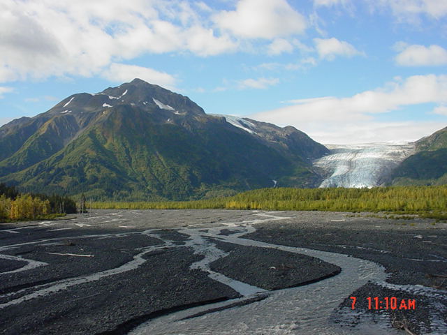
During this time as we looked around and over the embankment we could see the river flowing down the valley. In the distance we could see Exit Glacier coming out of the valley floor rising up toward the mountaintop.
A little history lesson and some information about this incredible place.
—biologist for the
Kenai Fjords National Park lies along the Kenai Peninsula coast in southcentral Alaska, just southwest of
The exposed valley is a natural laboratory where we can see the processes of life reclaiming a barren landscape: moss, lichen and fireweed colonize the bare rock; followed by grasses, shrubs, alders, and cottonwood; and
finally, a spruce-hemlock forest grows where 200 years ago only ice and rock existed.
Exit Glacier is accessible by road and thousands of park visitors have an opportunity to experience the glacier firsthand.
Driving into the Exit Glacier ranger station you go over the bridge of the
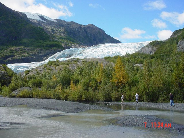
This was the location of the ice at the turn of the century. We drive past this sign for a mile when we arrive at the visitor’s center. The sky has cleared; the temperature has warmed to a comfortable 65 degrees F. The light breeze is bringing with it the smells of the wild flowers on the mountainside. It has a fresh crisp smell and there are the sounds of birds singing in the
trees. An idyllic setting as we walk down the trail towards the glacier.

We can see the ice rising above the trees going up the mountainside about ¼ mile away. It is a nice walk down a paved path here before you arrive at the river. This is a nice walk with no real crowds today with about 12 other people here. They are spread out so you never see more than 2 or 3 people at any given time.
No one is in any hurry. The fireweed is in bloom and there are other flowers here but the patches of fireweed is what jumps out at you as everyone wanders along.

The path turns to the left over a small stream and shortly turns into a dirt walkway through the trees. This part has not been improved yet but is maintained nicely. The path opens up to the riverbed where we take a group picture.

There is a little walkway out into the flow of the river for about 15 feet where we are looking into the water to see if any fish are around. We notice a small chunk of ice float by, then another, and
another. This is so cool as we realize that these small pieces of ice are coming from the Glacier. We walk along the river bed looking at all of the small rocks and how different the many stones appear.
Most are very smooth and seem to have been ground down to almost a perfect oblong shape. A few others have carved out indentions in them where it appears a small stone or pebble has been swirled around for a period of time with the water rushing around keeping the pebble in place making the groove or indention.
Charlie and Mike in bottom right corner of the picture.

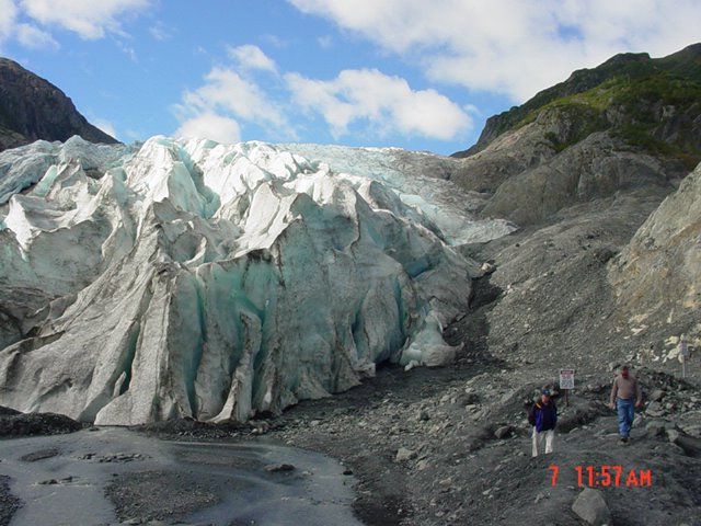
We walk right up to the wall of ice and can see the glacial green color and within about a minute can hear the groans and creaks of the ice as it makes it retreat.
Understanding Glaciers by Susan Huse
—biologist for the
To map the history of a glacier’s movements, one must first understand how glaciers work.
Alpine glaciers, like Exit Glacier, form when more snow falls on mountain peaks during the year than melts during the summer. As the snow pack builds up and thickens, its weight compresses the snow beneath and turns it to ice.
As more and more snow and ice accumulate, the glacier grows. The weight of the ice high in the mountains begins to push the ice below, down the mountain, and it actually flows very slowly down through the valley. The movement of the glacier scrapes the ground beneath, scouring the valley floor, and carrying along the dislodged rocks and debris. Rock avalanches from the peaks and the valley surrounding the glacier add more debris. With time the growing glacier becomes a jumbled mix of rock and ice.
We are walking around looking at the ice and the different formations and can see how different ones have fallen off the face and sides as it makes it way. We can see a few people up on the trail that overlooks the area we are in about 300 feet up the mountainside. We wanted to make that hike but chose to do it on another trip back here.
"Icewind"
We spend about an hour looking around and start making our way back to the riverbed and continue looking at the millions of small stones here. My mind is racing thinking about how insignificant man is in the universe in the grand scheme of things.
There are literally millions of stones here in this part of the valley. They have been ground by the pressure of tons of ice, movement, and the weather over the centuries. This is such a minute speck of

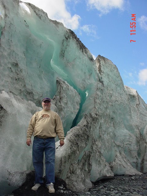
I am happy that this little side trip was made that day as it brought us an experience like none before. To touch the cold surface, to hear the sounds and noises coming from within this massive ice structure was incredible. It was amazing and hard to describe and my words here do it no justice.
If the chance comes to you to visit one of these beautiful places I would recommend it. I was in awe and moved by the power of nature and God’s wonderful work.
Oh yeah, remember in the first post I said we were going fishing?
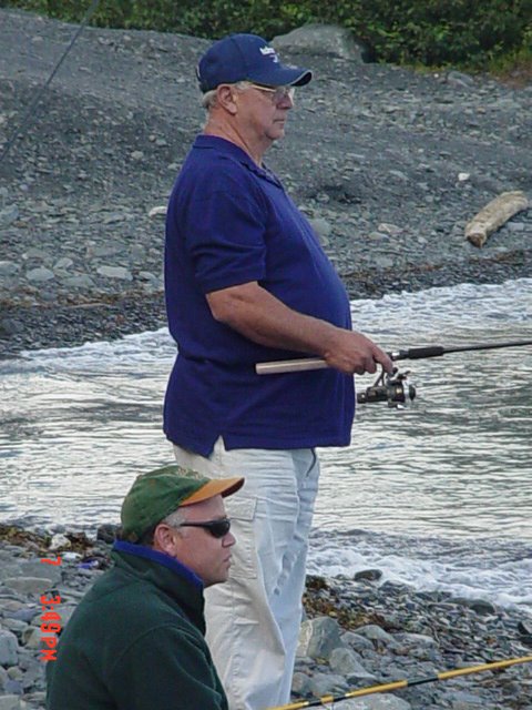
We finally made it late in the day.
Father and son.
I hope you enjoyed.
Ice


Comments